Unknown's avatar

About Mary Ames Mitchell

Writer, Graphic Designer, and Explorer.

Lighthouse Road Trip – Day 9 – Lincoln City to Winchester Bay

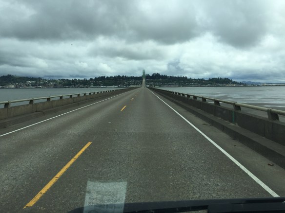
Today we got up close and personnel to four lighthouses, drove through two national forests and three “creek wildernesses”, crossed four major rivers, and turned out at three unusual rock and sea formations named after the devil.

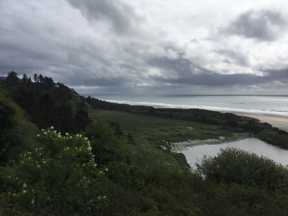
Leaving the Siuslaw National Forest, we took the turnout for Boiler Bay, a cove that you would not find comforting in a boat of any size.

Another cove of crashing surf was called Devil’s Churn.

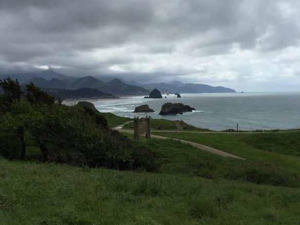
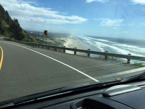
I think my favorite view was from the point on Cape Foulweather (named by Capt. James Cook in 1778) overlooking the town of Otter Rock.

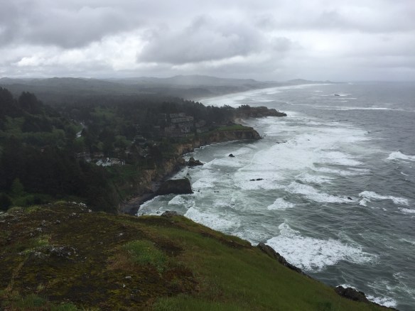
Once you reach Otter Rock, you find the Devil’s Punch Bowl

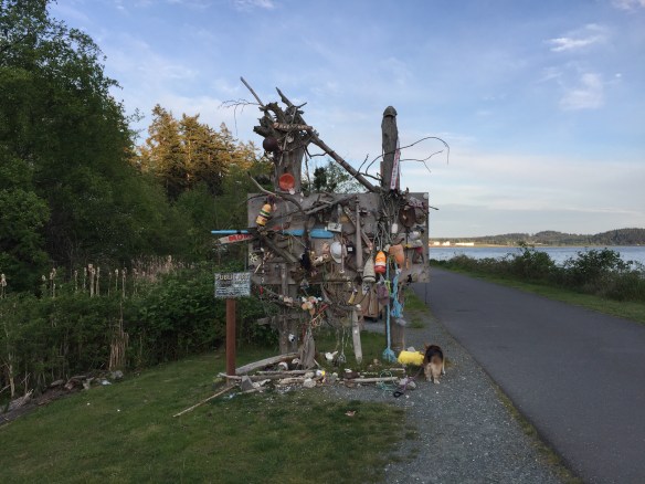
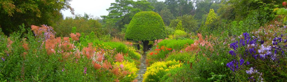
and this tree decorated with floats.

Shortly after Otter Rock, we reached the Yaquina Head Lighthouse, one of the most visited lighthouses in the US. It is cared for by the Bureau of Land Management, so those of us with National Parks’ Senior Passes got in free.

After learning in the Visitor’s Center everything there is to know about Oregon’s tallest (93 ft.) lighthouse, some of us drove and some of us walked the 1/3 mile to the lighthouse itself. The interior of this lighthouse is not open for viewing until summer.

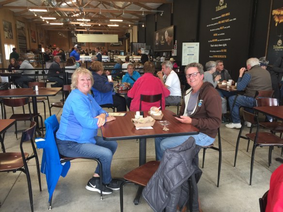
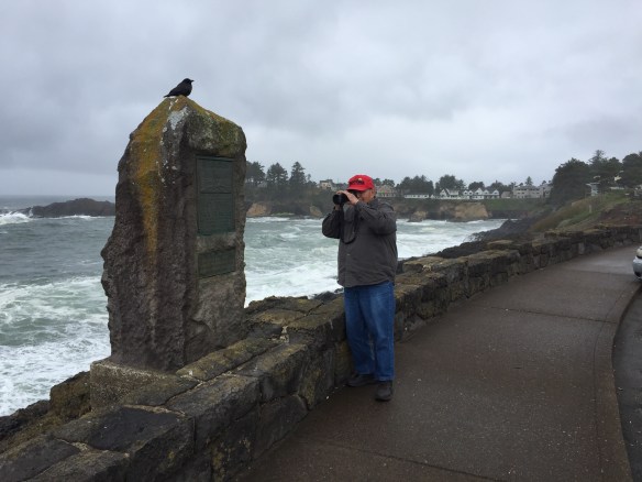
Bill and BJ were armed with more serious cameras than my iPhone.

The Yaquina Bay Lighthouse is only 4.91 miles down the road from the Yaquina Head Lighthouse. It’s small, but offers a peek inside, set up as the keeper’s quarters would have looked in the 1880s. He had seven children.

To be a keeper, a man had to be married. It was preferable that he had kids, theory being he would stay longer. Other qualifications included the ability to write (to keep the records) and be strong enough to pull a boat.

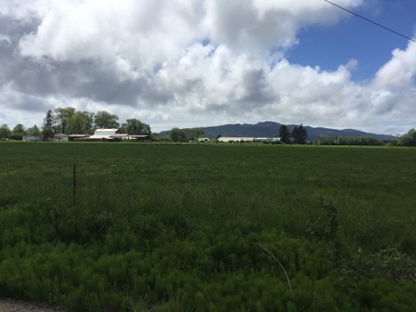
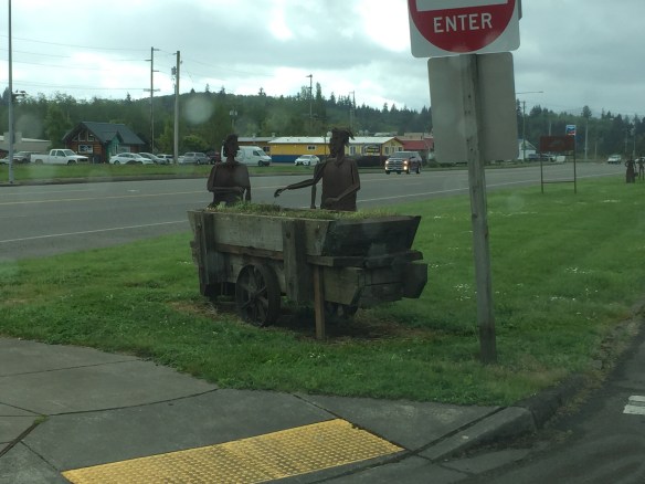
After that, I found an inviting turnout/park with a placard about Lewis and Clark and early fur trading and took my nap.

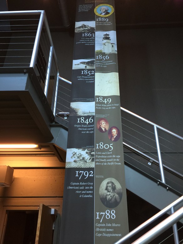
37.4 miles farther (there were, at the lighthouse peak, lights approximately every 40 miles) we came to the Heceta Head Lighthouse named after the Basque explorer Bruno de Heceta y Dudagoitia, who surveyed the northwest coast for Spain in 1775 in the 36-foot Sonora.

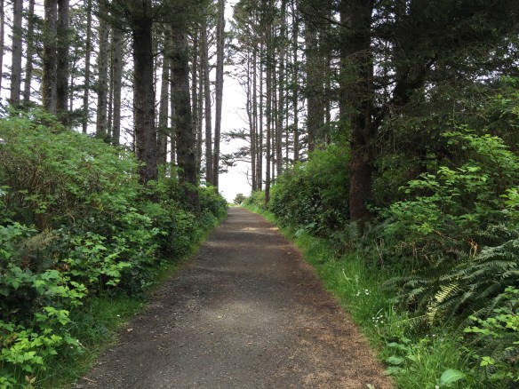
We got some much needed exercise walking up the hill.

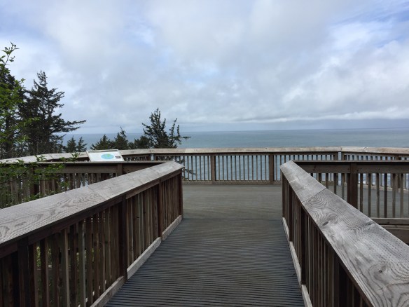
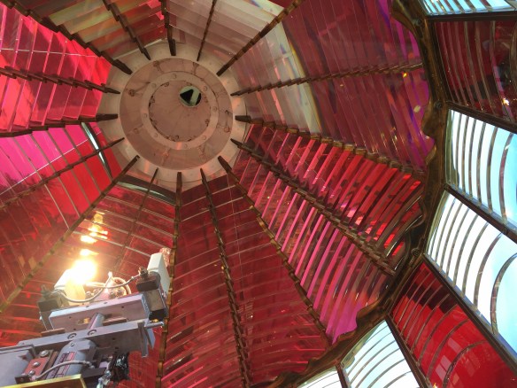
Another path led us to a place where we could look directly at the light which can also be seen 26 miles out at sea. The Fresnel-designed lens was built in England because the French manufacturer was backlogged two years. More trivia: The French glass is clear and the English glass has a yellow tinge.

Legend states that the 12,787-pound lens was shipped from England in a crate of molasses to keep it from breaking or getting scratched.

A volunteer showed us the first floor of the interior. The layout, similar to many lighthouses, consists of a workroom, short arched hallway, and stairwell to the light. No dogs are allowed inside, so Peggy (right) and her Shady missed this tour.

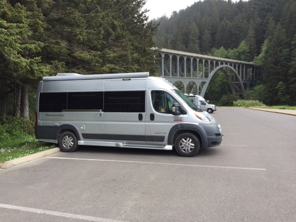
My corgi Annie had waited patiently in the van.

We drove 39.7 more miles past beaches and through forests to the Umpqua River Lighthouse in Winchester.

A few of us were lucky enough to snag Ed (at right), a volunteer who had just closed up the lighthouse for the day, to open it again.

This is the only lighthouse, in Oregon at least, where visitors can look inside the lens, a rare French model.

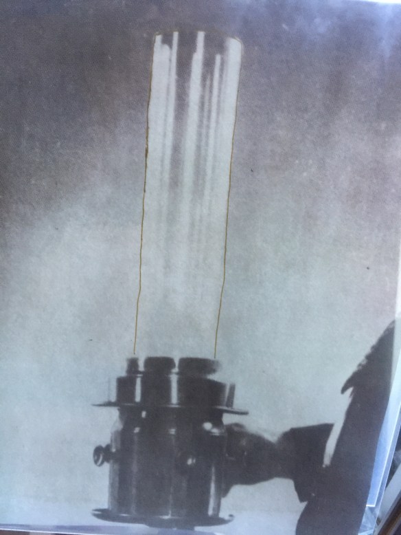
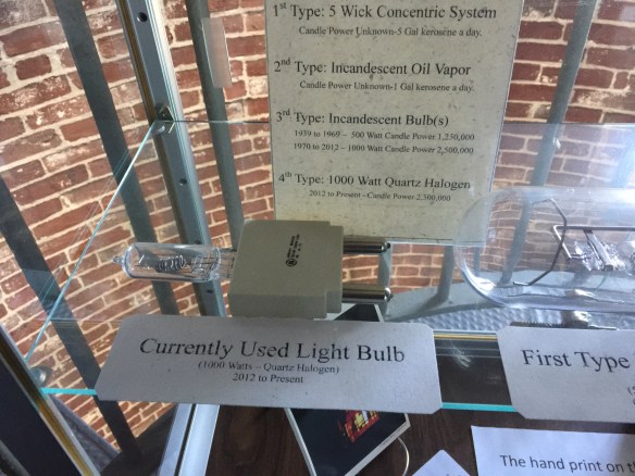
A display showed the progression of light sources – from kerosene lamp to electric bulb.

The biggest treat was climbing the ladder into the lens. Installed in 1894, it still functions perfectly. I caught a really cool video, but I can’t get it download right now.

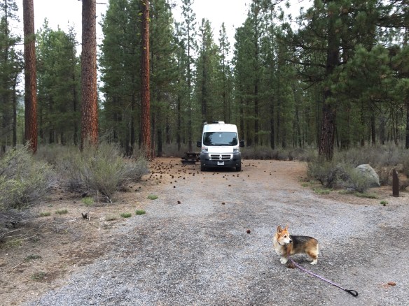
William M. Tugman State Park Campground is home for the night. We are parked around a cluster of yurts.

Tomorrow I need to make the decision to backtrack five miles to visit the Sourdough Bakery in Winchester, or head straight to the next lighthouse in Coos Bay 25.7 miles south.

Lighthouse Road Trip – Day 8 – Tillamook & Lincoln City

Turns out there have been 19 of us PleasureWay owners cruising the west coast of Washington and Oregon. We became 20 when Sherrie and Tina met up with us here in Lincoln City.

After a quiet night under the trees in Fort Stevens State Park Campground, we wiggled our way down Oregon’s dramatic coast to Cannon Beach. From there a turn-off gave us the closest view possible of the Tillamook Rock Lighthouse. As its name implies, the lighthouse sits on a rock — built there a mile away from shore in 1881. If you look on Wikipedia at a closer shot of the rock, you’ll see it appears like a monster head coming out of the sea. The Indians and 19th century seamen had a heyday creating stories and legends about it.

Looking south, we saw this.

Yes, it is still raining off and on. But we have had some glorious sunny moments, too.

Next stop, lunch at the Tillamook Cheese Factory a little over an hour south through more gorgeous vistas interrupted by the occasional jarring patches left by clear cutting.

I met up with Bill and Rita at one turnout.

And we enjoyed a cheesy lunch together.

The next task was supposed to be finding the Cape Mears Lighthouse. Trouble was, the planned route was closed. It being way past my nap time with a tummy heavy from grilled cheese and a chocolate mint ice cream cone, I was too tired to make the extra effort to find the alternate route. I headed south through cow farms.

And sloughs.

And coastline. This is the beach at Pacific City.

Now we are nestled in our vans parked in the Premier RV Resort in Lincoln City. At cocktail hour we gathered in the community room to rehash our days.

Lighthouse Road Trip – Day 7 – Wallapa Bay and the Mouth of the Columbia River

Yesterday was actually Day 3 for my PleasureWay Convoy, but 7 for my trip starting in Marin County.

From Westport we headed south on 101, forest on the left and the Pacific in the right. As you can see, it was raining, but no matter.

Entering Pacific County, we came to the north end of Wallapa Bay, where from pre-colonial times, locals have harvested oysters. This truck is hauling away the shells from a canning company,

I stopped in at Raymond, a tiny rundown town.

A metal artist has sprinkled sculptures of people doing various everyday things on nearly every roadside and corner. He has also cut rabbits, deer, and other animals from sheet metal, now covered with a rusty patina. It was still raining, so these photos are dark.

This old relic was built as a Sears Roebuck.

A monument to logging graces the center of town across from the post office.

At the south end of Wallapa Bay we turned to the coast to see two lighthouses that guard the entrance to the Columbia River. North Head Lighthouse is still functioning and open to the public. Built in 1893, its beam extends 17 miles out to sea. The light was originally lit with kerosene, which had replaced whale oil. The two buildings to the right housed 6 months worth of kerosene each.

There is also a short walk to a point that was used as a weather station and guard house during World War II.

North head is one of the windiest places on the coast and continues to be a place from where weathermen measure.

Here are some of our vans in the parking lot.

Just a couple miles south looms Cape Disappointment Lighthouse. The cape was named by Captain Mears in 1788. He was looking for the mouth of a great river hoping it was the Northwest Passage. How he missed the Columbia, we can only guess?

‘Cape D’ Lighthouse was built a few years before North Head, but boat pilots complained they couldn’t see it soon enough when approaching the river from the north.

This is also the location of the Lewis & Clark Museum. The self-guided tour describes their adventure, which culminated at viewing the Pacific for the first time here.

They also have one of the lenses designed by Augustin Fresnel that were used in most lighthouses after 1822. He used prisms stacked in the shape of a beehive to enhance the lights made from the kerosene flames.

From the museum we viewed the Cape D Lighthouse.

After reading about all of Lewis and Clark’s travel woes, it was amazing to see the Astoria Bridge spanning the entire river mouth from Washington State to Oregon.

Turning left after crossing the bridge and driving through the 19th century town of Astoria, I had 15 minutes to see the Columbia River Maritime Museum before it closed.

Finally we reached our home for the night, Fort Stevens State Park Campground — another good find by Tom O’Malley.

Lighthouse Road Trip – Day 6

Another gorgeous day touring the countryside of western Washington State. I skipped visiting the first lighthouse on our list in favor of following my new friends Bill and BJ who are locals of the Tacoma area. They drive a Pleasureway Pursuit, which is roomier than my Lexor, but equally agile.

Bill and BJ showed me Twanoh State Park on the Hood Inlet. The fiord is shallow, hence the water gets warm in summer.

Bill spent many happy times as a child swimming, boating, and fishing there. He and BJ provided the same enjoyment for their children.

The drive from Gig Harbor to the Pacific Coast -— where we would find Gray’s Harbor Lighthouse — took about three hours — a little more if you count my stop in Aberdeen for a nap.

Gray’s lighthouse is Washington’s tallest.

It was closed, giving those of us who wanted one, an excuse not to climb its 132 steps.

Tim O’Malley, our fearless leader, had made rezzies for us at the American Sunset RV Park just six minutes from the lighthouse.

It’s in the fishing village of Westport where some of us (including Hans and Merrilee in the video) went to have a look around, and where most of us gathered for a fish and chips dinner at Beckett’s on the main drag.

Tomorrow we follow the coast southward 111 miles to the next grouping of lighthouses and the mouth of the Columbia River.

I am going to insert one more video of the American Sunset RV Park just to give them a plug. The new owners were great and the park has everything. Only tip, Verizon works better then my T-Mobile hence this latish post.

Lighthouse Road Trip – Day 5

Finally we get to the lighthouses.

After a short visit to the adorable town of Coupeville, my group of 20 PleasureWay owners took a ferry to Port Townsend. Here is Ramsey on his first boat ride.

A short drive later we inspected the Point Wilson Lighthouse in Port Townsend. The current building was erected in 1913.

From there it was about an hour and a half to the next stop, which has a funny name, the Point No Point Lighthouse. The original was built on 1882.

Along the way we passed a house built from the remnants of a boat. It’s for sale in case you are interested. I didn’t catch the asking price.

Now we are settled for the night at the Gig Harbor RV Resort though we can’t see a harbor anywhere.

This is what a heard of PleasureWays looks like grazing on a hill.

I’ll insert the screenshots of our route below.

And here are some extra shots I liked.

Lighthouse Road Trip – Day 4 – Anacortes, Washington

Ok, no pix of lighthouses yet, but I promise some tomorrow.

As I wrote in my last post, I spent last night in the driveway of my college roommate’s house in Portland.

This isn’t going to seem like a big deal to most of you, but it was the first time in the year I have been camping in Ramsey that I reached a perfect pitch on my leveler. The bubble was in the exact middle. (The rig needs to be somewhat level to turn on the propane for the fridge.)

Jane and I had a great visit then I aimed my GPS toward Anacortes.

You might notice that there are two national parks close to the route, and, as some of you know, my goal in the next ten years is to see all the national parks in the contiguous USA. But I learned they are still snowed in. Another time.

The most eventful moments driving up Interstate 5 were crossing through Portland and Seattle, both along waterways spanned by a sculptural maze of concrete motorways.

The landscape of Anacortes is very different. We are staying in the Fidalgo Bay RV Resort facing gorgeous Washington coastline as well as a Shell Oil refinery.

There is a great path for walking Annie.

The above public art piece invites you to add anything you are inspired to contribute.

Best of all, it is a place to experience some peace. (The noise in the background was a man closing his awning.)

I’ve met up with our PleasureWay group.

Tomorrow we’ll hit the road and start our eight-day tour lighthouse hopping.

Lighthouse Road Trip – Days 2 & 3 – Crater Lake & Portland

As mentioned in the last post, I’m on my way from Marin County in California to Anacortes, Washington, to meet up with fellow Pleasureway owners to cruise the lighthouses on the Pacific Coast. My brainstorm to post everyday using my iPhone got busted when I traveled through national forests and parks with no cell service. So, this is a recap of yesterday.

From Andersen, I drove through Shasta-Trinity National Park and over Shasta Lake.

Soon, Mount Shasta himself loomed ahead.

The Castle Crags towered to my left.

I turned off Interstate 5 (old Hwy 99) to Hwy 97 at Weed.

Then, as you can see from the screenshot above, it’s just over two and a half hours to Crater Lake National Park in Oregon.

Before climbing the mountain that was once a huge volcano and now a bowl of water, I drove through a beautiful green valley that, said a roadside placard, is at the same altitude as the bottom of Crater Lake.

20 minutes later, Annie and I were in a place that gets more snow than any other inhabited place in the US.

Only a short section of the Rim Toad is open. I had to be happy with what I could see of the continent’s deepest lake from Rim Village.

There was also a terrific movie about the lake played every half hour in the visitor center. After getting my National Parks Passport stamped, I retraced my steps to the town of Chiloquin on Hwy 97 where the Parks Ranger told me I could find two good campgrounds.

Colliers State Campground to the right was crowded. I then went to Williams on the left, run by the US Forest Service. Perfect. And only $5/night with my National Parks Senior Pass.

The next day (this morning) I was off to Portland where I am spending the night in Ramsey parked in the driveway of my college roommate Jane’s house. Tomorrow I make my final trek to Anacortes and you will start seeing some lighthouses in my photos.

Lighthouse Road Trip – Day 1 – Andersen WalMart

This is my first attempt at blogging from my phone as a road trip progresses. On May 6, I will meet up with 20 other PleasureWay Class B RV owners in Anacortes WA. From there we will cruise south along the Pacific Coast from lighthouse to lighthouse, ending our “rolling rally” in Trinidad CA. First leg, get to Anacortes from Marin County CA.

Yesterday, I made it to Andersen at the northern end of California’s Central Valley. I was aiming for Redding 12 miles farther, but I called the WalMart there and learned that a city ordinance prevents them from allowing RVs to park overnight. The ‘associate’ helpfully suggested I call the Andersen WalMart and here I am. I’ve seen so many videos about staying at WalMarts that I’m excited to finally try it.

I arrived around 7:30 and took Annie for a walk enjoying a warm evening. I then steamed some asparagus to go with the roast chicken I’d bought at Sprouts and ate while watching the world go by in the Andersen super center. What a kick.

Tomorrow I head to Crater Lake National Park.

Death Valley, not a great place for an old dog.

A trip I intended to last five days turned into a three-day dash to, through, and from Death Valley. Annie, my fourteen-year-old corgi, did not do well in the heat, which is why I cut the trip short. It was still an amazing get-out-to-see-my-country experience. Here’s the vlog.

And here’s the route.

RouteToDeathValley