Lighthouse Road Trip – Epilogue

Ann Delfin sent me the group photo that our PleasureWay RV group took of ourselves on the last night of our nine-day rolling rally. Here it is.

PleasureWay RV Club Lighthouse Rolling Rally - Group Shot

PleasureWay RV Club Lighthouse Rolling Rally – Group Shot

Here is a map showing the lighthouses and RV Campgrounds we visited.

Lighthouse Rolling Rally

And here is the whole trip starting in Anacortes compiled into a 25-minute YouTube video.

Thanks again Tim O’Malley for organizing everything.

Death Valley, not a great place for an old dog.

A trip I intended to last five days turned into a three-day dash to, through, and from Death Valley. Annie, my fourteen-year-old corgi, did not do well in the heat, which is why I cut the trip short. It was still an amazing get-out-to-see-my-country experience. Here’s the vlog.

And here’s the route.

RouteToDeathValley

Camping near the Russian River

I just posted this video on YouTube about a loop I took from my home in San Rafael to the Russian River. After a night near Guerneville, I drove about 15 minutes to Jenner on the coast at the mouth of the river. Then I headed south along the cliffs to Bodega Bay, then home. I’ve included a 24¢ tour of my rig. The good news about traveling in January is that there is room in the campgrounds. The bad news is the mud, as you shall see.


Pinnacles National Park


IMG_4583-RamseyPkgLotBearGulch

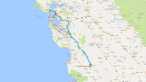
I intend to visit all the National Parks in the contiguous US within the next ten years. The US has fifty-eight National Parks. Hawaii has two and Alaska has eight, which leaves forty-eight parks in the contiguous US. Until last week, I had seen only two of them: Yosemite and the Channel Islands. Last week  I visited my third, Pinnacles National Park, leaving me forty-five to go. Pinnacles is about 3.5 hours south of my home in San Rafael, small, and uncrowded.

Route

Pinnacles is the nation’s newest National Park. In 2013, Congress upgraded it from National Monument. It is known for it’s rock formations (duh!), the place where the California condor was released, and for the largest amount of species of bees in the world. It is supposedly a rock climber’s paradise, but a rock climber I am not. With my National Parks Senior Pass, I got 50% off the campground site and free entry to the park. I paid $18/night for the campsite.

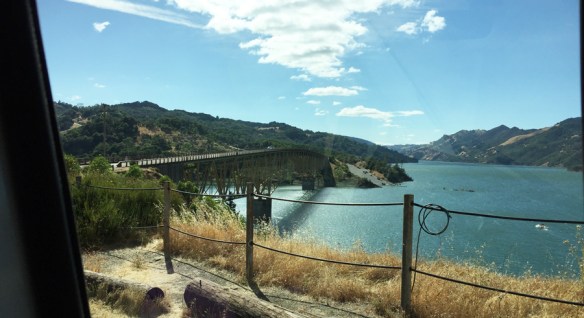
California was still having a heat wave. Daytime weather fluctuated between 102 and 108 degrees during my two-day trip. The air was also hazy from all the wildfires in California and Oregon. Not so great for taking photos.

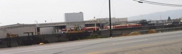
I left civilization after driving through Gilroy, known for its garlic. I passed this industrial area with a line-up of trucks full of the pungent bulbs …

2520-GarlicTrucks

… followed by a block of market stands selling garlic braids and other local produce. I bought a basket of Bing cherries thinking I was supporting the local farmers. Turned out they came from the state of Washington. Oh well.

DSCF2338-RoadsideStand

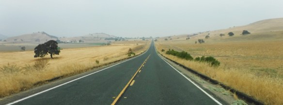
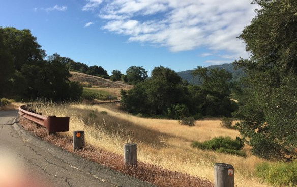
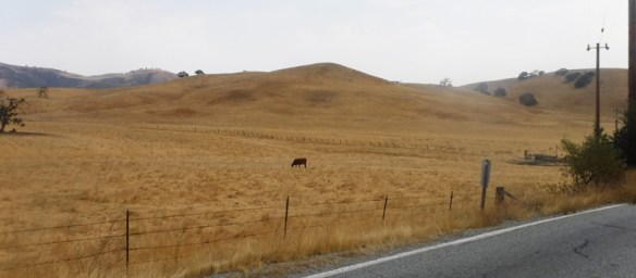
The road from Gilroy to San Benito County, where the park is, consisted of farms and golden fields of grassland.

2344-FarmLand

2425-goldenHills

I passed the San Benito County fairgrounds, where, interesting to me, there was a sign saying that RV parking was available.

2373-SanBenitoFairground

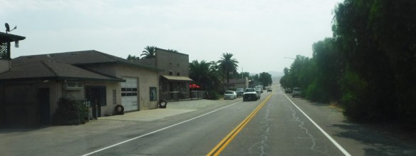
A sign as I entered the tiny town of Tres Pinos (population 500) let me know it was the last place I could purchase gas. I had already tanked up at the Costco in Gilroy.

2363-TresPinos

DSCF2368-Roadsign

DSCF2509-Farm

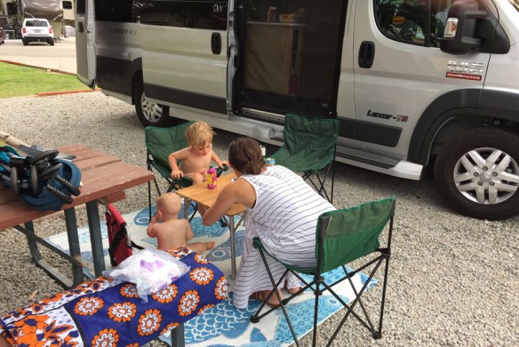
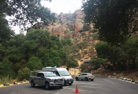
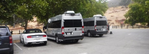
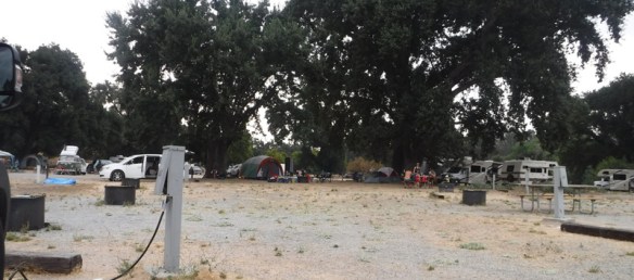
After more grassy hills, I came to the RV campground, which is not within the pinnacles, but about a mile east. I pulled into the parking lot of the visitor center and parked right next to a Roadtrek version of Ramsey.  Roadtrek is the major competitor to PleasureWay, the company that built Ramsey on a Dodge Promaster 3500 truck chassis. The Roadtrek was also built on that chassis. You can see they are cousins!

2444-RamseyRoadtrek
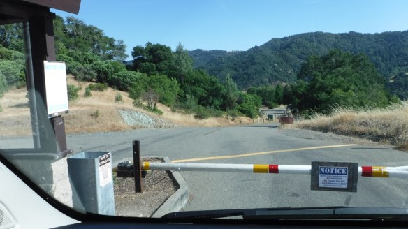
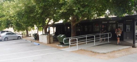
I checked in at the visitor center with my Senior Pass in hand. It was blissfully air-conditioned in there.

DSCF2443-VisitorCenter

It was about 1:00. The park let me in earlier than their formal check-in time. Annie and set up camp at spot number 106, which was the far eastern end of the loop.

PinnaclesCampground

Then we returned to the Visitor Center, this time with my National Parks Passport in hand. One ranger held Annie’s leash while another ranger took this video of me stamping my first National Parks stamp in my passport.

Passport

After that, we returned to the rig. It was so hot, there was nothing more we could do than crank the air-conditioner to full speed, read, and eat the cherries, which had been cooling in my fridge.

DSCF2449-Cherries

Around 4:00 we took a tour of the campground. I looked through the telescopes that aim at the hills where the condors live. Placards explain that the difference between the condors and the turkey vultures is a white patch under their wings. I saw a lot of dark blobs in the trees, but nothing I could clearly identify as a condor.

DSCF2460-CondorTelescope

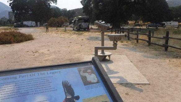
The ranger said wild turkeys often roam the camp but I saw none. I did spot this deer and a wild hare. Quails scurried everywhere.

DSCF2482-DeerHare

It being too hot to take a hike, I purchased an ice cream sandwich at the visitor center and sat on the porch to people watch. The dog friendly visitors kept Annie well petted.

DSCF2466-visitorCenter

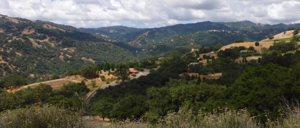
From the east end of the campground, it is possible to hike to the pinnacles area. There are two major places people hike. One is a shortish walk through Bear Gulch that takes about 45 minutes. The other is to the highest pinnacles known as the Balconies. That takes much more time. There is very little parking, maybe ten spaces, at the beginning of the trails. Most people take a shuttle from the Visitors Center to the trail head and hike from there. The shuttle leaves every 20 minutes, starting at 9:00 in the morning.

2455-SignToBearGulch

Pets are not allowed on the trails. Since I didn’t want to leave Annie in the rig and take the shuttle, I decided to take my chances and drive Ramsey to the parking lot by the Bear Gulch trail head early in the morning and leave her there. We left at about 8:00 am.

DSCF2505-EntranceSign

The parking lot was mostly shady, and the temperature cool and overcast. I felt secure Annie would be comfortable.

IMG_4583-RamseyPkgLotBearGulch

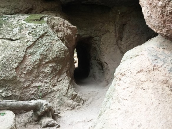
My destination was the small Bear Gulch Reservoir, which one reaches through a trail encrusted with boulders and caves. My three-year old grandson, who loves to climb steps and rocks, would have been in Paradise. Bats live in many of the caves, but the areas where they breed are closed off at this time of year.

DistanceSign

4605-CavesCombo

Fortunately, I had learned ahead of time that I would need a flashlight for some of the caves. There were a few that were completely dark.

IMG_4625

I climbed the steps in the photo above and came out to the pretty little reservoir.

Pinnacles-Reservoir

The clouds began to clear, which meant time to head back before it got hot inside Ramsey.

Tunnel

A few more caves and I was on the road for home.

DSCF2517-road

RVing with the Grandkids

As expected, Hurricane James loves Ramsey the RV. James and his brother, Felix, their mom, and I took a trip together a few weeks ago. Destination: the Paso Robles Ranch and RV Park, which is roughly half way between my daughter’s home in the LA area and mine in the SF area. We slowly made our way up Highway 101 with frequent stops. Felix needed nursing and James needed to run around.

We made it to Paso Robles a bit after 5:00 pm. Even though it was officially dinner time, Mom consented to a swim in the Park’s pool, which, for the boys, was the best part of the whole “camping trip.”

Dinner consisted of hot-dogs grilled on my new mini-Weber and string beans I had marinated with dill ahead of time. We called them pickle beans so James, who loves pickles, would eat them. He ate a couple.

Breakfast

We had bought ingredients for smores, but didn’t have an open fire. Besides, it was getting late and the last thing James needed was sugar. It was hard enough calming him down for the night as it was, he was so excited. For Felix, who isn’t crawling yet, Amy and I had built a bed from a cardboard box which fit on the floor in the front part of the cabin without blocking the door to the bathroom. We cut the mattress from an exercise mat – something like a yoga mat, but thicker. We used two thicknesses covered with a cotton blanket and a crib sheet. (Obviously, this photo wasn’t taken inside Ramsey.)

FelixBed

Eventually morning came. Amy and I enjoyed our café lattes while James watched Netflix on the iPad (Wifi provided by the Park). Felix kept busy playing with Ramsey’s measuring spoons and cups.

MorningCoffee

In Gilroy, on the final stretch to the Bay Area, Ramsey provided an private dining room when we stopped at In-N-Out for lunch.

In-n-Out

 James is hiding under the table.

The great thing about this PleasureWay Lexor is that it can fit in most parking spots.

RamseyIn-n-out

After a week’s visit, including a walk through the Muir Woods (subject of next blog), I delivered Amy and her boys back to the LA area in my regular car. We left my house after lunch and drove during the boys’ naps to Livermore, where James could wear himself out on the Lost World Adventure play gym.

LostWorldAdventure

After sharing a plate of nachos at Chili’s for dinner, we completed the 5-hour drive down I-5 while the boys slept quietly.

Camping was fun, but I think we’ll wait until the boys are a tad older before taking any more long trips. An hour out of town, maybe, but not an eight-hour drive that took us sixteen-hours to make.

Liberty Glen Campground – Lake Sonoma

For my first 2-night sleepaway in Ramsey, the dogs and I headed 1.45 minutes north to Lake Sonoma. Because of the usual backup between Novato and Petaluma, Google Maps took us through the cow farms west of Highway 101 – gorgeous. I love the black and white cows. Jerseys? We emerged from the detour in downtown Petaluma, then continued through Sonoma County’s equally gorgeous and serene wine country.

DriveThruVineyards

Since I don’t drink wine, I wasn’t tempted by the wineries offering tastings. But I did stop for a look-see at the Dry Creek General Store – Est. 1881. I purchased some crackers and some spread made of walnuts and pomegranate, for a cocktail hour later.

DryCreekGenStore

Lake Sonoma is the result of a dam, which is the first thing you see from the vineyard lined highway. After driving over the dirt covered dam and through some hills, you come to a full vista of the lake.

LakeSonomaBridge

I knew from Recreation.gov’s website, where I’d made my reservation, that Liberty Glen Campground (run by the U.S. Army Corps of Engineers) is not on the lake. It is in the hills to the left of the above photo.

LibertyGlenCmpGd

You can only see the sign as you exit the campground, not as you approach it, which is when I needed to know if I was in the right place. But since Google told me I had arrived at my destination, I turned into what appeared to be a driveway, followed the switchbacks into the valley, and eventually reached the gatehouse.

LibertyGlenEntrance

LakeSonomaHeader

In the photo above, I am looking down on the campground from the road that leads to it.

I also knew from the website that Liberty Glen has no water at the moment. It was perhaps 10% occupied if that and hence available, whereas the other campgrounds within two hours from home were not. The ranger told me to drive around the three loops and pick a spot, then return and report my decision. I chose a hilltop with the view seen in the feature photograph above that was on the opposite side of the campground from several large groups with packs of dogs.

For my first time, I needed to level Ramsey. I placed my bubble level on the fridge shelf, as my manual told me to do. Ramsey was leaning to the left. So I tucked a few of my lego-like leveling blocks behind the left tires and drove backward until my tires were on top of them. The bubble in my level had moved within the two center circles.

LevelingRamsey

Good enough. I turned on the LP (liquid propane), switched my fridge from electric to propane (and lit it), and set out a table and chair overlooking the valley. Time for cocktail hour and a good book.

CoctailHour

During the next two days, the dogs and I took several walks around the campground. Basil, the Norwich Terrier, is a burr magnet, so we avoided the trails. Those beautiful golden hills are, at close look, a mass of burrs of every shape and size.

WalkwayLibertyGlen

RamseyLibertyGlen

This was true dry-camping, aka boondocking, since we had no electric, water, or sewer hookups. I didn’t even have a cell connection – perfect conditions for forgetting the troubles of the real world to sleep and eat in quiet. The $25/night paid for a locked campground where I felt very safe.

Mid-day Saturday we took a jaunt into the nearby town of Geyserville for a touristy look around.  You can see the whole town center in this photograph.

Geyserville

Since I had already had lunch in Ramsey, I purchased a café latte at the coffee shop to justify sitting at its outdoor table to watch the world go by. Everyone was dog-friendly and patted Basil and Annie as they passed – so they were happy. I also wanted to check my email and messages because my two-month-old grandson was suffering from his first cold and I wanted to make sure he was OK, which he was.

The next two trips I have planned are simple visits to friends that I seldom see because they live too far away to allow for going out to dinner or lunch – one in Santa Rosa and one in Sebastopol. I will park Ramsey on the street in front of their houses for the night. We’ll see how that goes.

MapLakeSonoma