Little Ol’ Lady in Pasadena

Pasadena is famous for the tiny cottages ‘grandfathered’ into the back of properties in neighborhoods reserved for single-family dwellings. My daughter and son-in-law do not have one of those cottages, which is why I visit in Ramsey. This time I upgraded from parking him on the street to shimmying my way up the driveway to park in the backyard. It was a tight squeeze, but worth it — quieter and a safer walk to my front door for my tiny grandsons.

Camping near the Russian River

I just posted this video on YouTube about a loop I took from my home in San Rafael to the Russian River. After a night near Guerneville, I drove about 15 minutes to Jenner on the coast at the mouth of the river. Then I headed south along the cliffs to Bodega Bay, then home. I’ve included a 24¢ tour of my rig. The good news about traveling in January is that there is room in the campgrounds. The bad news is the mud, as you shall see.


Quarantined on South Lake Avenue

For eight straight days, my family and friends banned me from their presence. The day after I drove to Southern California to spend the weekend with my fellow RVers in Indio, then a week with my grandsons in Pasadena, I came down with a very bad cold. Kaiser claimed it was not the flu or strep because of the low-grade fever.

I lay in Ramsey. Thank goodness dogs don’t catch very bad colds. Annie curled up at my feet. Indio was quiet. The air was beautiful, and birds chirped constantly. My biggest disappointment was missing the pickleball. I had been taking lessons for weeks in preparation. I had even purchased my own paddle and balls.

On Sunday I felt well enough to drive through Joshua Tree National Park on my way to Pasadena (see separate blog). Joshua Trees can’t catch very bad colds. I wasn’t as strong as I thought and on Monday I couldn’t move. For the next six days, with my daughter’s resident parking pass stuck to my front window, I lay in cozy Ramsey and felt sorry for myself.

[Image source: http://www.thedepartmentstoremuseum.org/2010/05/bullocks.html]

My daughter lives on South Lake Avenue two blocks away from the commercial district. When I was a little girl in the early 50s, South Lake was a fashionable shopping center dominated by the architecturally gorgeous and elegant Bullocks Department Store and her sister, I.Magnin. When my grandmother took me shopping there, we wore gloves. When I was a young adult, I envied women who could afford to shop at Gene Burton’s just south of I.Magnin. Shoppers took a rest sipping a peppermint soda or eating lunch at Blum’s. The fashionable purchased gifts, such as French Quimper Ware and hand-hemmed handkerchiefs, at Port O’Call across the street.

Today, Macy’s occupies the Bullock’s building. The modern Macy’s typography does not sit well like the handwritten script for Bullock’s did. Paint peels from the building. A huge chunk of white concrete packed with stores and markets dominates the street corner and blocks the view of what was once a gracious entrance to the Bullock’s building. I.Magnin is a Barnes & Noble. A Ross for Less dominates everything else. What happened to city planning?

Pinnacles National Park


IMG_4583-RamseyPkgLotBearGulch

I intend to visit all the National Parks in the contiguous US within the next ten years. The US has fifty-eight National Parks. Hawaii has two and Alaska has eight, which leaves forty-eight parks in the contiguous US. Until last week, I had seen only two of them: Yosemite and the Channel Islands. Last week  I visited my third, Pinnacles National Park, leaving me forty-five to go. Pinnacles is about 3.5 hours south of my home in San Rafael, small, and uncrowded.

Route

Pinnacles is the nation’s newest National Park. In 2013, Congress upgraded it from National Monument. It is known for it’s rock formations (duh!), the place where the California condor was released, and for the largest amount of species of bees in the world. It is supposedly a rock climber’s paradise, but a rock climber I am not. With my National Parks Senior Pass, I got 50% off the campground site and free entry to the park. I paid $18/night for the campsite.

California was still having a heat wave. Daytime weather fluctuated between 102 and 108 degrees during my two-day trip. The air was also hazy from all the wildfires in California and Oregon. Not so great for taking photos.

I left civilization after driving through Gilroy, known for its garlic. I passed this industrial area with a line-up of trucks full of the pungent bulbs …

2520-GarlicTrucks

… followed by a block of market stands selling garlic braids and other local produce. I bought a basket of Bing cherries thinking I was supporting the local farmers. Turned out they came from the state of Washington. Oh well.

DSCF2338-RoadsideStand

The road from Gilroy to San Benito County, where the park is, consisted of farms and golden fields of grassland.

2344-FarmLand

2425-goldenHills

I passed the San Benito County fairgrounds, where, interesting to me, there was a sign saying that RV parking was available.

2373-SanBenitoFairground

A sign as I entered the tiny town of Tres Pinos (population 500) let me know it was the last place I could purchase gas. I had already tanked up at the Costco in Gilroy.

2363-TresPinos

DSCF2368-Roadsign

DSCF2509-Farm

After more grassy hills, I came to the RV campground, which is not within the pinnacles, but about a mile east. I pulled into the parking lot of the visitor center and parked right next to a Roadtrek version of Ramsey.  Roadtrek is the major competitor to PleasureWay, the company that built Ramsey on a Dodge Promaster 3500 truck chassis. The Roadtrek was also built on that chassis. You can see they are cousins!

2444-RamseyRoadtrekI checked in at the visitor center with my Senior Pass in hand. It was blissfully air-conditioned in there.

DSCF2443-VisitorCenter

It was about 1:00. The park let me in earlier than their formal check-in time. Annie and set up camp at spot number 106, which was the far eastern end of the loop.

PinnaclesCampground

Then we returned to the Visitor Center, this time with my National Parks Passport in hand. One ranger held Annie’s leash while another ranger took this video of me stamping my first National Parks stamp in my passport.

Passport

After that, we returned to the rig. It was so hot, there was nothing more we could do than crank the air-conditioner to full speed, read, and eat the cherries, which had been cooling in my fridge.

DSCF2449-Cherries

Around 4:00 we took a tour of the campground. I looked through the telescopes that aim at the hills where the condors live. Placards explain that the difference between the condors and the turkey vultures is a white patch under their wings. I saw a lot of dark blobs in the trees, but nothing I could clearly identify as a condor.

DSCF2460-CondorTelescope

The ranger said wild turkeys often roam the camp but I saw none. I did spot this deer and a wild hare. Quails scurried everywhere.

DSCF2482-DeerHare

It being too hot to take a hike, I purchased an ice cream sandwich at the visitor center and sat on the porch to people watch. The dog friendly visitors kept Annie well petted.

DSCF2466-visitorCenter

From the east end of the campground, it is possible to hike to the pinnacles area. There are two major places people hike. One is a shortish walk through Bear Gulch that takes about 45 minutes. The other is to the highest pinnacles known as the Balconies. That takes much more time. There is very little parking, maybe ten spaces, at the beginning of the trails. Most people take a shuttle from the Visitors Center to the trail head and hike from there. The shuttle leaves every 20 minutes, starting at 9:00 in the morning.

2455-SignToBearGulch

Pets are not allowed on the trails. Since I didn’t want to leave Annie in the rig and take the shuttle, I decided to take my chances and drive Ramsey to the parking lot by the Bear Gulch trail head early in the morning and leave her there. We left at about 8:00 am.

DSCF2505-EntranceSign

The parking lot was mostly shady, and the temperature cool and overcast. I felt secure Annie would be comfortable.

IMG_4583-RamseyPkgLotBearGulch

My destination was the small Bear Gulch Reservoir, which one reaches through a trail encrusted with boulders and caves. My three-year old grandson, who loves to climb steps and rocks, would have been in Paradise. Bats live in many of the caves, but the areas where they breed are closed off at this time of year.

DistanceSign

4605-CavesCombo

Fortunately, I had learned ahead of time that I would need a flashlight for some of the caves. There were a few that were completely dark.

IMG_4625

I climbed the steps in the photo above and came out to the pretty little reservoir.

Pinnacles-Reservoir

The clouds began to clear, which meant time to head back before it got hot inside Ramsey.

Tunnel

A few more caves and I was on the road for home.

DSCF2517-road

Balancing Rocks — Culver, Oregon

2291-combo

Relatively recently, I became interested in early man’s efforts to communicate through rocks and rock drawings or pictographs. I had no idea how many ancient rock formations are sprinkled around New England. Some, such as the structures at America’s Stonehenge in New Hampshire, have been carbon dated to over 2000 years old. I joined the NEARA (New England Antiquities Research Association), went to one of their conferences, and learned more about analyzing, finding, and preserving these often ancient and mysterious structures.

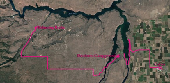
One type of rock formation common in New England is balancing rocks. When I learned there was a field of balancing rocks in Culver, Oregon, which I visited to watch the solar eclipse, I just had to see them. (They are also called the Metolius Balancing Rocks, even though you get there from Culver.) No one knows who positioned these rocks, how, or when. The National Park service has marked them on their maps, provided detailed instructions on how to reach them from one of its campgrounds (directions inserted below), and built a path for us to walk out to see them.

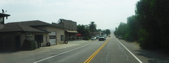
Still, finding the rocks was not easy. I made many wrong turns before reaching them. I started my search by asking the locals at Culver’s coffee shop, “Do you know how to get to the Balancing Rocks?” Most of the people I talked to confused them with a structure known as Shipwreck. “They are only 20 minutes away,” they told me. Wrong. It takes 35 minutes to reach the rocks from Culver. The drive itself is an adventure.

PathToBalancingRocks
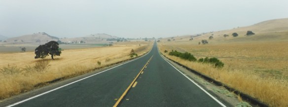
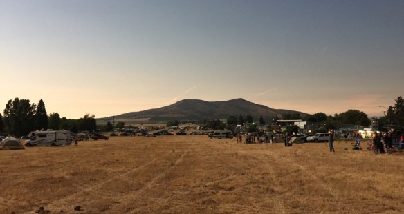
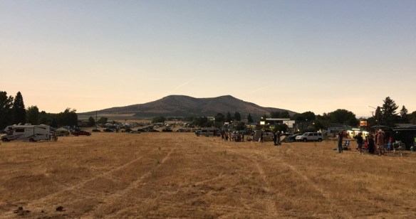
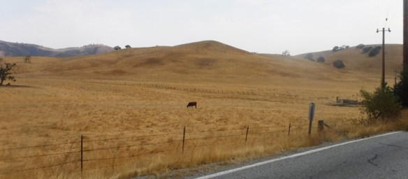
Culver is on a vast plain. It looks flat as far as you can see. (That is Mt. Jefferson in the background.)

FlatsOfCulver

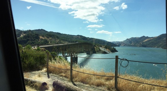
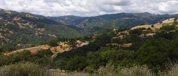
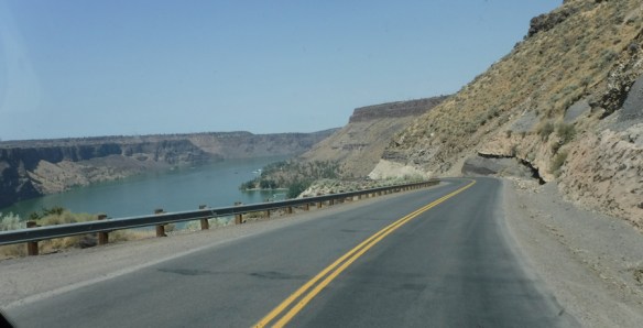
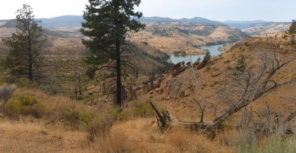
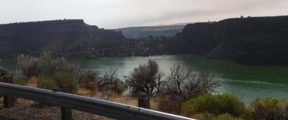
But the Crooked River (aka the Metolius River, a tributary of the Deschutes River) has cut a mini grand canyon that has two forks. After driving along the flat roads, you suddenly plunge into the canyon toward the Billy Chinook Lake, part of Cove Palisades State Park. The lake formed when people built the Billy Chinook Dam across the Crooked River. Sorry about the bug splats on my window.

CovePalisadesStatePark

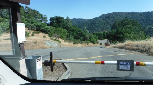
I knew I was supposed to skirt the lake for a while until I came to a bridge. This bridge had two lanes.

2271-bridge

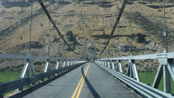
On the other side of the bridge, I skirted the lake for another quarter mile then climbed the canyon wall and came out on the land between the two forks of the lake. I wove through some low, rocky hills and came to the Deschutes Campground, where a ranger gave me the written directions I needed. From the campground, the drive is 13.9 miles west. I wound my way to the the second canyon and plunged down once again, where I crossed the fork of the lake on a single lane bridge. That meant I had to make sure no one was coming from the other direction. Or if there was a line for the bridge on the other side, I had wait for my turn. I was the only one around. Point is  — this was not a well traveled road to an important tourist destination.

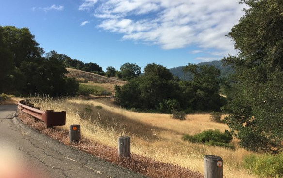
On the other side of the bridge, I climbed out of the canyon, then followed straight roads through flat wooded, desert and dusty land. Again, you can see Mt. Jefferson in the distance.

2275

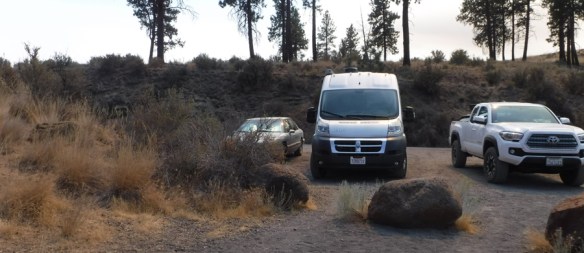
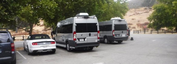
I made right angle turns, as you can see from my map above. At milage point 13.5, the pavement ended and Ramsey bumped along a gravel road going up a hill. My RV does not have four-wheel drive, but I only had .4 miles to go. I could see Road 1170 marked on the left, the only landmark that told me I was in the right place. A turnoff on the right served as a three-car parking lot, marked by the first sign I had seen saying “Balancing Rocks.”

2279-parkingLot

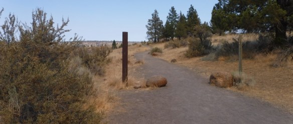
A path obediently led from the parking area. My directions told me to look for the Balancing Rocks to my left about a quarter mile down the path.

2278-Path

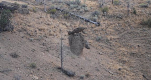
Sure enough, there they were.

2283-path2

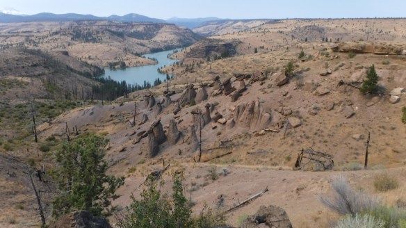
The path led to the right around the top of a ridge, from where I could climb down to the area of the rocks. I noticed from this angle that the pillars seemed to form an arrow. I checked the compass app on my iPhone and learned that the arrow pointed north. Mt. Jefferson is to the left, almost due west of the rocks. I would love to visit again during a solstice to see if the sun comes up any where near Mt. Jefferson.

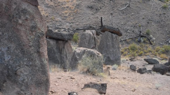
Most of the balancing stones, which were shaped as rough arrow points, also pointed north. (These stones were shaped by breaking, not worn away by water.) When I reached the stones, I walked around with my copper divining rods, but I’m not very experienced at using them and they didn’t make any interesting movements.

2287

2288

2291-combo

2290

2293

2297

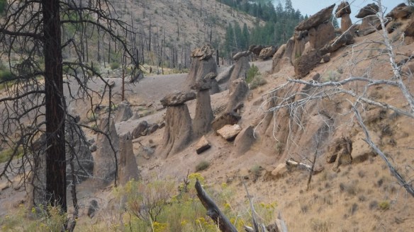
These next four photos were taken on the other side of the ridge from the main cluster of stones.

2298

2299

2302

2303

Faithful hound, Annie, waited patiently while I snapped pictures. The photo of her gives you a close up of the rock bed. The balancing rocks seemed to be of a darker stone than the pillars on which they balanced.

2305

Time to go home. I followed the path back along the ridge away from the stones.

2306

I took these two photos from the path along the ridge as I walked back to the parking area, the second by zooming in.

2307

2308

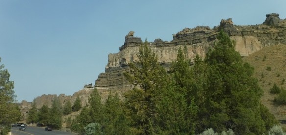
On the way back to Culver, I passed the rock formation that I assume is called Shipwreck Rock. It is indeed about 20 minutes from Culver.

2310

I climbed back up the canyon after crossing both bridges again. From this point, I could see one canyon from the other.

2312

I crossed the RR tracks as I returned to Culver.

2317

One web article stated that the rocks were for a long time hidden from the public even though the National Forest Service rangers knew about them. A forest fire in 2002 revealed their existence to the public. That same article stated, “The rock spires were created by one volcanic eruption, while the balancing slabs on top were created by others. Because of their differing sedimentary make-up, the rocks eroded at different rates.” After studying the New England balancing rocks, I don’t believe that statement for a minute. I think people purposefully created these structures to state a message, which probably has something to do with the agricultural calendar and the celestial bodies.

If anyone reading this can support my claim, I would love to hear from you.

Here is a website about other balancing rocks around the world:

http://www.waymarking.com/cat/details.aspx?f=1&guid=4480cfa2-58a5-40b0-9a18-14811fc24a3a&st=2

As promised, here are the directions to the Balancing Rocks from the Deschutes Campground — as given to me by the State Park Ranger service. These structures could have been formed by man thousands of years ago. Help us preserve them.

Essentially, you follow the main paved road for the first 13.5 miles. It turns to gravel for the last .5 mile. It is passable by passenger vehicles, although it includes steep curves. Easy parking is available for two passenger vehicles (not trailers). Allow 1/2 to 1 hour driving time one way.

Mile 0 – Turn left out of the campground onto Jordan Road, proceed to the Deschutes Bridge.

Mile 1.5 – Carefully proceed across the one land bridge and follow Jordan Road to the top of the canyon.

Mile 5 – Bear right to stay on the main paved road.

Mile 7.1 – Pass the Three Rivers Recreation Area on the right.

Mile 10.5 – You will enter the National Forest Land. Stay on the paved road. You will see evidence of forest fire.

Mile 13.5 – The pavement ends.

Mile 13.8 – Road 1170 will head off to your left. Continue on your path.

Mile 13.9 – Take the first turnoff to the right. This is the parking area for Balancing Rocks.

Park your can and hike about 1/4 mile down the dirt path. Look for the Balancing Rocks on your left.

Have fun and stay safe.
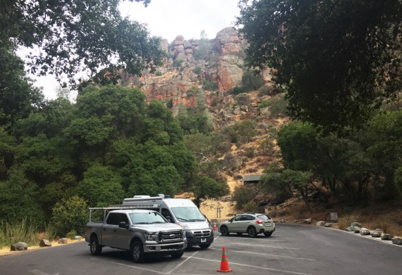
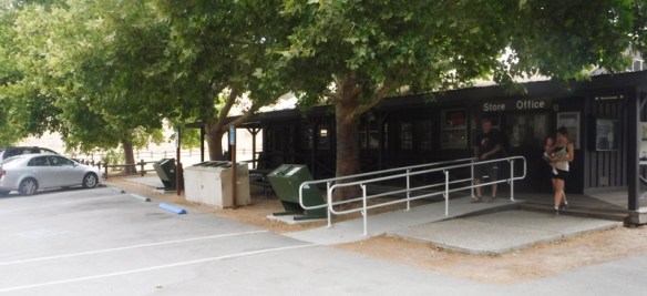
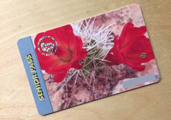
 

Along the Path of Totality — Culver, Oregon

RamseyBrianHebbsField

Ramsey on Brian Hebb’s Field, Culver, Oregon.

It was handy having an RV with solar panels on August 21, 2017 — the date of the Solar Eclipse. People in the small towns of Oregon along the Path of Totality were offering places for people like me to camp only if we could dry camp i.e. boondock i.e. camp without hooking up to water, electricity, and/or a sewer.

A friend of mine wanted to meet her boyfriend in Oregon along the Path of Totality. He was headed to Oregon from Idaho. After some worrying research, during which we found most campgrounds along the Path full or extremely expensive ($750 and up for three nights), we found Brian Hebb’s field in Culver, Oregon, only 9 miles south of Madras off Highway 97 ($255). Whereas the full eclipse was expected to last 2 min 2 seconds in Madras in the center of the Path, it would last 1 min 53 seconds in Culver — a difference we would not notice at all.

So, we packed Ramsey up for 5 days. Since my friend is a vegan, we needed two sets of food. Her small dog ChaCho, 20± years old, required a special homemade stew, which needed most of Ramsey’s tiny freezer. Considering he was deaf and blind, he was good company for my corgi, Annie, and very affectionate.

nasa_eclipse_map

PathToCulver

Whereas Madras turned out to be crowded and expensive, Culver was a delightful tiny town and wonderfully peaceful. I was amazed at how friendly and accommodating the locals were, and surprised to meet many townies who had grown up there and never wanted to leave.

We were among the first to arrive and had Brian Hebb’s field all to ourselves. The field had been in Brian’s family for years. When the city lot closer to the hills filled up, City Hall asked Brian if he would temporarily convert his hay field into an RV lot for the big event. The town is on the right, the park down on the left. That is the full extent of Culver.

Culver-Oregon

Culver happened to be having its annual CrawDad Festival that very weekend. Saturday I attended the parade, which started at 10:00 am, followed by the festival in their not-so-central park. I can’t show my photos of the parade of vintage cars, the local sherif, the local fire truck, and the local ambulance, because there were children lining the street and, legally, I can’t show photos of children without their parents’ permission. As the cars passed, the drivers and passengers threw out candy for the kids, who had come armed with bags to collect the candy, just like for an Easter hunt. The scene warmed my heart. I loved it that the children knew and admired there law enforcement people.

The festival consisted of booths in the park selling local crafts such as woodworking, photography, jewelry, crocheted baby blankets, and hand batiked baby clothes.

FestivalWares

The line for the crawdads, harvested from the near-by man-made Billy Chinook Lake, extended from the booth where they were served at one end of the park to the other end of the park. It remained that long until about 3:00 that afternoon and the food ran out.

CrawDadLine

CrawdadDishes

I passed on the crawdads. I wasn’t very hungry. It was too hot. I purchased an ice cream cone instead and slurped it while listening to the country band.

Band

Meanwhile, kids, and a few campers needing a shower, cooled themselves off in the Culver fountain.

Fountain

My friend’s boyfriend and his terrier, Clayton, met up with us on Sunday morning. The two vans created a mini courtyard in the field. That evening, we hung out in the Culver’s one and only bar, drank some beers, and listened to the town chatter about the eclipse due the next morning.

Courtyard

I didn’t take a video of the eclipse itself. You can see better images of that anywhere on the internet. What I did was take photos of the hills (to my left as I took the photo of the RVs above) to show the change in light. It also got so cold that I put on my fleece jacket.

10-19

By 10:19 am it was noticeably darker.

10-20

At 10:20 am, the light went out. Everyone around us cheered. I wish I could have photographed the festive moment the sun appeared again. There was a burst of light.

10-21

A minute later, at 10:21 am, it looked like this.

10-26

10:26 am

10-30-peopleLeaving

10:30 am. I took this photo of the cars and RVs that were already leaving by 10:30, even though the eclipse had another hour to go. Some people really wanted to avoid the crowded roads.

MarieWatching

10:38 am. My friend Marie kept watching.

RusselWatching

10:38 am. Her boyfriend Russell kept watching.

11-41-Last

At 11:41 am, the last little nub of moon covering the sun disappeared, ending the eclipse. Marie and Russell left about a half hour or so later, headed for Crater Lake. I stuck around for the rest of the day. I planned to wait a day to drive home and I wanted to visit the nearby Balancing Rocks, which I will tell you about in the next post.


Muir Woods National Monument

While my daughter and her two boys visited me in August, we took a walk through the Muir Woods National Monument, which is 30 minutes on a super-curvy road over the hill from my house. My third grandson, who is four months old, pushed in his stroller by his mother, joined us.

Important to my quest to see the National Parks, I obtained some useful items from the Visitor Center.

1) A Senior Pass. Cost for my lifetime: $10 (going up to $80 in October!) Three adults can accompany me on this pass. The children are free.

SrPass

2. My National Parks Service Passport. I bought one for each of my grandsons, too.

3. A stamp on my passport. Muir Woods isn’t a National Park, so this doesn’t count for my quest, but the passport is a start.

PassPort

The trail loops up one side of the narrow valley of tall trees and back the other. The loop is connected by frequent bridges across the valley. There are also trails heading out from the loop, but we stuck close to the entrance. There isn’t much more to say about the woods that you can’t see in the photos.

MuirWoodsEntrance

MuirWoodsCombo

J-MuirWoodsLillies

MuirWoodsBridge1


RVing with the Grandkids

As expected, Hurricane James loves Ramsey the RV. James and his brother, Felix, their mom, and I took a trip together a few weeks ago. Destination: the Paso Robles Ranch and RV Park, which is roughly half way between my daughter’s home in the LA area and mine in the SF area. We slowly made our way up Highway 101 with frequent stops. Felix needed nursing and James needed to run around.

We made it to Paso Robles a bit after 5:00 pm. Even though it was officially dinner time, Mom consented to a swim in the Park’s pool, which, for the boys, was the best part of the whole “camping trip.”

Dinner consisted of hot-dogs grilled on my new mini-Weber and string beans I had marinated with dill ahead of time. We called them pickle beans so James, who loves pickles, would eat them. He ate a couple.

Breakfast

We had bought ingredients for smores, but didn’t have an open fire. Besides, it was getting late and the last thing James needed was sugar. It was hard enough calming him down for the night as it was, he was so excited. For Felix, who isn’t crawling yet, Amy and I had built a bed from a cardboard box which fit on the floor in the front part of the cabin without blocking the door to the bathroom. We cut the mattress from an exercise mat – something like a yoga mat, but thicker. We used two thicknesses covered with a cotton blanket and a crib sheet. (Obviously, this photo wasn’t taken inside Ramsey.)

FelixBed

Eventually morning came. Amy and I enjoyed our café lattes while James watched Netflix on the iPad (Wifi provided by the Park). Felix kept busy playing with Ramsey’s measuring spoons and cups.

MorningCoffee

In Gilroy, on the final stretch to the Bay Area, Ramsey provided an private dining room when we stopped at In-N-Out for lunch.

In-n-Out

 James is hiding under the table.

The great thing about this PleasureWay Lexor is that it can fit in most parking spots.

RamseyIn-n-out

After a week’s visit, including a walk through the Muir Woods (subject of next blog), I delivered Amy and her boys back to the LA area in my regular car. We left my house after lunch and drove during the boys’ naps to Livermore, where James could wear himself out on the Lost World Adventure play gym.

LostWorldAdventure

After sharing a plate of nachos at Chili’s for dinner, we completed the 5-hour drive down I-5 while the boys slept quietly.

Camping was fun, but I think we’ll wait until the boys are a tad older before taking any more long trips. An hour out of town, maybe, but not an eight-hour drive that took us sixteen-hours to make.

Liberty Glen Campground – Lake Sonoma

For my first 2-night sleepaway in Ramsey, the dogs and I headed 1.45 minutes north to Lake Sonoma. Because of the usual backup between Novato and Petaluma, Google Maps took us through the cow farms west of Highway 101 – gorgeous. I love the black and white cows. Jerseys? We emerged from the detour in downtown Petaluma, then continued through Sonoma County’s equally gorgeous and serene wine country.

DriveThruVineyards

Since I don’t drink wine, I wasn’t tempted by the wineries offering tastings. But I did stop for a look-see at the Dry Creek General Store – Est. 1881. I purchased some crackers and some spread made of walnuts and pomegranate, for a cocktail hour later.

DryCreekGenStore

Lake Sonoma is the result of a dam, which is the first thing you see from the vineyard lined highway. After driving over the dirt covered dam and through some hills, you come to a full vista of the lake.

LakeSonomaBridge

I knew from Recreation.gov’s website, where I’d made my reservation, that Liberty Glen Campground (run by the U.S. Army Corps of Engineers) is not on the lake. It is in the hills to the left of the above photo.

LibertyGlenCmpGd

You can only see the sign as you exit the campground, not as you approach it, which is when I needed to know if I was in the right place. But since Google told me I had arrived at my destination, I turned into what appeared to be a driveway, followed the switchbacks into the valley, and eventually reached the gatehouse.

LibertyGlenEntrance

LakeSonomaHeader

In the photo above, I am looking down on the campground from the road that leads to it.

I also knew from the website that Liberty Glen has no water at the moment. It was perhaps 10% occupied if that and hence available, whereas the other campgrounds within two hours from home were not. The ranger told me to drive around the three loops and pick a spot, then return and report my decision. I chose a hilltop with the view seen in the feature photograph above that was on the opposite side of the campground from several large groups with packs of dogs.

For my first time, I needed to level Ramsey. I placed my bubble level on the fridge shelf, as my manual told me to do. Ramsey was leaning to the left. So I tucked a few of my lego-like leveling blocks behind the left tires and drove backward until my tires were on top of them. The bubble in my level had moved within the two center circles.

LevelingRamsey

Good enough. I turned on the LP (liquid propane), switched my fridge from electric to propane (and lit it), and set out a table and chair overlooking the valley. Time for cocktail hour and a good book.

CoctailHour

During the next two days, the dogs and I took several walks around the campground. Basil, the Norwich Terrier, is a burr magnet, so we avoided the trails. Those beautiful golden hills are, at close look, a mass of burrs of every shape and size.

WalkwayLibertyGlen

RamseyLibertyGlen

This was true dry-camping, aka boondocking, since we had no electric, water, or sewer hookups. I didn’t even have a cell connection – perfect conditions for forgetting the troubles of the real world to sleep and eat in quiet. The $25/night paid for a locked campground where I felt very safe.

Mid-day Saturday we took a jaunt into the nearby town of Geyserville for a touristy look around.  You can see the whole town center in this photograph.

Geyserville

Since I had already had lunch in Ramsey, I purchased a café latte at the coffee shop to justify sitting at its outdoor table to watch the world go by. Everyone was dog-friendly and patted Basil and Annie as they passed – so they were happy. I also wanted to check my email and messages because my two-month-old grandson was suffering from his first cold and I wanted to make sure he was OK, which he was.

The next two trips I have planned are simple visits to friends that I seldom see because they live too far away to allow for going out to dinner or lunch – one in Santa Rosa and one in Sebastopol. I will park Ramsey on the street in front of their houses for the night. We’ll see how that goes.

MapLakeSonoma


Backyard Farming

Since I need to pay Marin County’s steep taxes to stay in my house, why not make the land pay for itself a wee bit. Artichokes have been growing in my garden since I moved here 12 years ago. The drought did a number on my normally prolific lemon tree, but it seems to be recovering since the rains. Tomatoes like it here, too.

This year I added lettuce, snap peas, kale, Swiss chard, and beans. I’m growing them hydroponically in a Tower Garden by Juice+. I bought the tower for my son and his wife for Christmas. His response, “I only grow flowers, Mom, nothing edible. Bugs!”

So the Tower Garden moved to my patio. Early April I planted some of the seeds that came with the apparatus. Juice+ provided a wool seed-womb. Two weeks later, on April 30, 2017, the sprouts looked like this.

3415

A few days later:

TG_3417_4-1-17

On March 1, I planted the seedlings into the tower.

On May 6, the garden looked like this.

TG_3492_5-6-17-combo

And today, June 7, it looks like this.

TG_3815_6-7-17

The chard isn’t faring well. But the kale, lettuces, snap peas and beans are thriving.

TG_3815_6-7-17-combo

A cord runs from the tower under my garage door to an outlet with a timer. I filled the base of the tower with 20 gallons of water and the nutrients Juice+ provided. A pump inside the base pumps water up the center of the tower. The water then trickles down through holes to fall on the roots that grow inward from the seedlings that I planted in the cubbies. There is no dirt involved. You can check out Juice+’s website if you want a detailed diagram.

At first, I only needed to add water and more nutrients every other week. With the hot weather and larger, thirstier plants, I add water every five days or so. It takes about 5 more minutes to check the ph. Juice+ provided what I needed to take those measurement, too.

One lesson learned. I thought I was being very green one day by topping my tub with leftover bath water. The only soap I use is Dove. I took a ph reading and the number had plummeted. Bad idea.

TG_3821_6-7-17-combo

Here is a photo of the greens I will chill for lunch.

TG_3824_6-7-17

A green “bon appetit.”